Bildegalleri
(1/1)

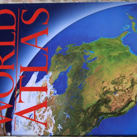
National Geographic Satellite Atlas Of The World.
Beskrivelse av varen
Tilstand: Som ny - Ikke synlig brukt
An innovative atlas incorporating the latest satellite imagery presents more than four hundred dramatic maps, illustrations, and satellite images that offer new information about Earth's topography, climate and weather phenomena, cities, and more. 25,000 first printing.
Publisher : National Geographic (November 1, 1998)
Language : English
Hardcover : 224 pages
ISBN-10 : 0792272161
ISBN-13 : 978-0792272168
Item Weight : 3.42 pounds
NB: Knappen for å vise hele beskrivelsen har kun en visuell effekt.
Privat selger
Du må være logget inn for å se brukerprofiler og sende meldinger.
Logg innAnnonsens metadata
Sist endret: 8.12.2024 kl. 11:54 ・ FINN-kode: 339183993