
2 000 kr
Oslo
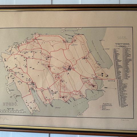
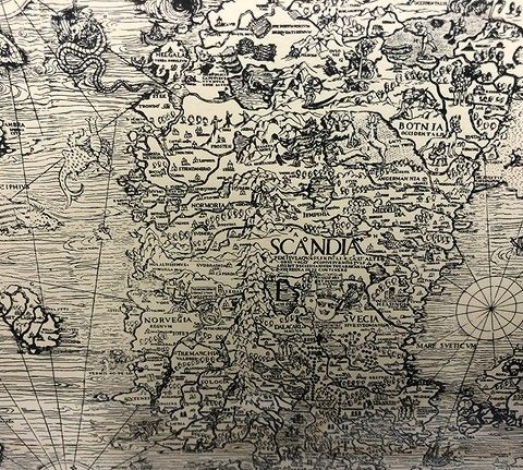
Et antikt kart over Norge. Kobbertrykk. Kan leveres på Østlandet mot tillegg.
Lotter, Gebrüder: Regnum Norwegiae Divisumin Quatuor Collegia quae Dicuntur Aggerhus, Christiansand, Bergen et Trondheim. // Nordland et Finmarken sub Colleg. Trondheim. 1760
English
Norway
Lotter, Fratr.
ca. 1760
copperplate engraving
Coloured
47,4 x 55,2 cm
T. & M. LOTTER - Regnum Norwegiae
Regnum Norwegiae
Hånkolorert kobberstikk, 58x50 cm
The kingdom of Norway with color coded provinces. An inset map show the northern most portion. A highly detailed ornamental cartouche is on the bottom left, above this a key highlighting settlements. To most Europeans until the 15th Century the geography of Scandinavia was largely unknown. Matthäus Albrecht Lotter (1741-1810) and his younger brother Georg Friedrich (1744-1801) worked in Augsburg, In addition to maps, they also produced globes. Their copper plates were often they signed with "dissolute brothers" or "Frères Lotter". They continued the work of Matthäus's father Tobias Conrad Lotter (1717-1777), in Augsburg. Tooley's Dictionary of Mapmaker, Early World Press, 2004, p158-159
https://www.oldmapcenter.com/3092.html
Du må være logget inn for å se brukerprofiler og sende meldinger
InnloggingSist endret: 5.6.2024, 19:02 ・ FINN-kode: 326895565