Bildegalleri
Kart fra nederland 1601- til 1620 til salgs
Beskrivelse av varen
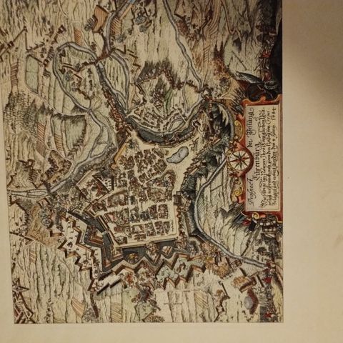
Netherlands, Helmond; Lambert Cornelisz/Ludovico Guiccardini/W.J. Blaeu - Hoc est civitas Hellmonda - 1601-1620
Map of Helmond in bird's eye view.
Object: Townplan
Country (current geographical location): Netherlands
Geographical specification: Helmond
Map maker/ publisher: Lambert Cornelisz/Ludovico Guiccardini/W.J. Blaeu
Map/ Book title: Hoc est civitas Hellmonda
Period: 1601-1620
Condition: Excellent
Technique: Copper engraving
Image size (H x W in cm): 24 x 35
Additional Information: Map of Helmond in bird's eye view.
The original print (1602) of Lambert Cornelisz is 14 x 17.5 (see website Rijksmuseum). The image is 24 x 35 in "Guicciardini, Lodovico. Beschryvinghe van alle de Neder-landen, anderssins ghenoemt Neder-Duytslandt (…)”, first published in the Netherlands in 1612 by Willem Janszoon Blaeu, 1612. However, that print is usually coloured and has the number ‘14’ written in within the frame’s line at the bottom right. Both things are missing in this one. It may be a test print.
( Ytterligere nedsatt ny pris kr 2500,-) Rammen på kartet er uten glass. Selve glasset er knust.
Ytterligere nedsatt pris kr 2400

Du må være logget inn for å se brukerprofiler og sende meldinger.
Logg innAnnonsens metadata
Sist endret: 13.12.2024 kl. 02:22 ・ FINN-kode: 134724577


